Altoona is growing fast. With new subdivisions, commercial areas, and infrastructure projects popping up across the city, smart planning is essential. At the heart of that planning is surveying.
Land surveying in Altoona gives planners the data they need to shape growth responsibly and efficiently. Let’s see how surveying helps guide the future of Altoona through seven key contributions.
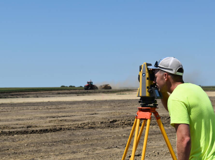
Mapping Growth from the Ground Up
Before construction begins, planners need to understand the land. Topographic surveys provide that insight. These surveys measure elevation changes, natural features, and existing infrastructure. They help identify areas suitable for building and those better left untouched.
Planners use this data to lay out streets, utilities, and lot lines in ways that fit the natural terrain. In growing areas like Altoona, this is critical for stormwater control, road stability, and cost-effective grading. Smart neighborhoods start with smart mapping.
Defining Boundaries to Avoid Disputes
Clear property lines are essential in new developments. Boundary and property surveys confirm the legal edges of a parcel. This prevents future disputes between neighbors and protects landowners, developers, and the city.
These surveys also help ensure that new neighborhoods comply with zoning regulations. Accurate boundaries support proper lot sizing, street widths, and utility placements. Without this step, even the most well-designed plans can run into legal and logistical trouble.
Planning with Flood Resilience in Mind
Flood-prone areas require special attention. FEMA flood surveys provide elevation data that shows where flood risks exist. Planners use this information to guide building locations, protect infrastructure, and reduce insurance costs for future homeowners.
By using elevation certificates and LOMA or LOMR applications, surveyors help confirm whether land sits inside or outside designated floodplains. This step protects both the land and the people living on it.
Supporting Infrastructure That Keeps Pace
Altoona’s growth depends on infrastructure that can handle increased demand. Surveying plays a key role in making sure roads, water lines, sewer systems, and storm drains are installed in the right place and at the right elevation.
Construction Staking
Surveyors mark precise points on the ground based on engineering designs. These marks guide contractors as they build roadways, lay pipes, or pour concrete. When done right, it keeps projects on track and avoids costly rework.
Utility Alignment
Proper alignment of utilities ensures neighborhoods operate smoothly for decades. Surveying helps planners and engineers avoid utility conflicts and design with future growth in mind.
Informing Smarter Land Use Decisions
Planners need to know more than just elevation and boundaries. Site investigations and feasibility studies uncover environmental concerns, zoning challenges, and infrastructure limitations.
Surveyors help gather this data early in the planning process. This gives planners the insight they need to recommend land uses that fit the site’s conditions. It also helps developers understand potential costs and timelines before breaking ground.
Smart growth in Altoona means using every acre wisely. Surveying makes that possible.
Enabling Efficient Construction and Long-Term Value
Good planning must translate into good construction. Surveyors help ensure that transition happens without delays or costly mistakes.
Machine Control Modeling
Surveying provides digital terrain models that guide automated equipment during grading and excavation. These models improve accuracy and reduce waste.
Building Layout Staking
From foundations to parking lots, staking ensures that builders place every element where it belongs. This precision keeps neighborhoods aligned, both visually and functionally.
Working With Local Experts for Lasting Results
Smart growth depends on smart partnerships. Local surveyors understand Altoona’s landscape, permitting process, and regulatory environment. That knowledge ensures projects move forward without unexpected setbacks.
Abaci Consulting brings over 25 years of experience to land development projects across Central Iowa. We’ve completed more than 25,000 projects. Developers, municipalities, and property owners trust us to deliver accurate, reliable data that supports long-term success.
Whether you’re building a new subdivision, expanding infrastructure, or reimagining existing spaces, we bring clarity and confidence to your project planning.
Build Altoona’s Future With Confidence
Surveying is more than measurements—it’s a foundation for smart, sustainable communities. As Altoona continues to grow, you may be facing complex challenges: balancing development with infrastructure needs, navigating regulatory hurdles, or finding reliable data to make confident planning decisions.
That’s where Abaci Consulting comes in. With decades of experience and more than 25,000 projects completed across Central Iowa, we know what it takes to support successful developments.
We understand the local terrain, regulations, and the pressure to get things right the first time. Our team delivers the precision and insight you need to move forward with confidence.
If you need land surveying in Altoona, call 515-986-5048 or email abaci@abaciconsulting.com to connect with experts who understand your land and your goals.