Commercial development involves tight timelines, strict regulations, and big financial commitments. Mistakes during planning or construction can delay your project and drive up costs. That’s why getting it right the first time matters. One of the most important steps? Accurate surveying.
From boundaries to construction layout, surveying helps you avoid costly setbacks. Here’s how land surveying Altoona developers rely on plays a critical role in starting commercial projects on the right foot.
Define Your Property Lines with Confidence
The first step in any commercial expansion is knowing exactly where your property begins and ends. Boundary and ALTA/NSPS land title surveys provide this clarity. These surveys identify legal property lines, easements, encroachments, and access points.
Without a reliable boundary survey, you risk building on neighboring property or missing required setbacks. Either scenario can lead to permit denials or legal disputes. Accurate boundary information also helps your design and construction teams work within the correct limits from the start.
ALTA/NSPS surveys are especially valuable during commercial real estate transactions. They combine property line data with improvements, easements, and zoning classifications to help all stakeholders understand what they’re working with.
Understand the Land Before You Build
Surveying goes beyond boundary lines. A topographic survey captures the natural and built features of your site—elevation changes, drainage paths, utilities, trees, and more.
This information is essential for engineers and site planners. It reveals how water will flow across the property and where earthwork may be needed. With this data in hand, your team can design grading plans, parking lots, and building pads that fit the existing terrain.
Overlooking topographic details can lead to poor drainage, erosion issues, or costly rework. A detailed survey allows your team to anticipate challenges early and avoid surprises once construction begins.
Place Utilities and Infrastructure with Precision
A successful commercial project relies on the precise placement of infrastructure. Surveying ensures that roads, utilities, drainage systems, and site features are built exactly where they belong.
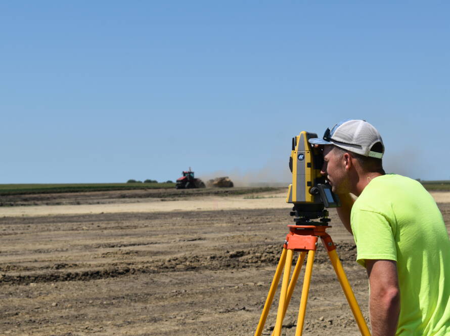
Construction Staking
Construction staking translates your site plan into physical markers on the ground. Surveyors mark where buildings, pipes, curbs, and pavement should go. These reference points keep crews aligned with the design.
Without staking, even small layout mistakes can compound. For example, if utility lines are installed a few feet off, they may interfere with other systems or require digging them up later. Staking eliminates that risk.
Utility and Parking Lot Staking
Surveyors also mark out water mains, storm drains, parking stalls, and driveways. Each of these features must meet local codes and design specs. Accurate staking helps contractors build within those parameters and pass inspections without issue.
By guiding contractors with exact measurements, surveying helps avoid construction errors that can delay your timeline or inflate your budget.
Meet Permitting and Compliance Requirements Early
Before you break ground, your project needs permits and regulatory approvals. Surveying provides the technical data required for those steps.
FEMA flood surveys, elevation certificates, and ALTA surveys are often necessary for permitting. These reports document existing conditions and prove compliance with floodplain, zoning, and access requirements.
Providing accurate survey data up front helps smooth the permitting process. Agencies can approve your plans faster when they’re supported by complete, reliable information. That means fewer delays and a more predictable construction schedule.
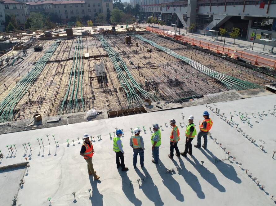
Keep Your Project Aligned from Start to Finish
Even with great plans, execution matters. Construction surveying keeps your project aligned as it moves from design to reality.
Machine Control Modeling
Machine control models help contractors automate excavation and grading. Surveyors prepare 3D terrain data that guides machinery. This allows operators to dig, fill, and shape the land with greater accuracy.
With machine control, site work becomes more efficient and consistent. It reduces the chances of over-excavation, rework, or uneven grading. Surveyors also perform ongoing checks to confirm that work stays on track.
Final Layout and Verification
Throughout the build, surveyors confirm that structures match the original plans. From building foundations to pavement layouts, they verify that everything ends up in the right place.
This final layer of accuracy helps avoid last-minute corrections that can hold up occupancy or inspection approvals.
Get It Right the First Time with Abaci Consulting
Challenges like unclear property lines, poor drainage, and utility misplacements can cause major delays and added costs. Surveying helps you avoid those issues by giving your team the clarity and accuracy needed to stay on track from day one.
If you’re planning land surveying Altoona developers count on, choose a team that understands local regulations, project pressures, and the importance of getting it right the first time.
Abaci Consulting brings over 25 years of experience and a track record of over 25,000 completed projects across Iowa. With our proven process, local insight, and commitment to precision, we help commercial developers build with confidence. Contact us today at 515-986-5048 or abaci@abaciconsulting.com to get started.