Underground utility conflicts are a leading cause of unexpected costs and project delays in construction. Severed fiber optic cables, damaged water lines, and unmarked gas mains can trigger safety hazards, costly repairs, and scheduling setbacks.
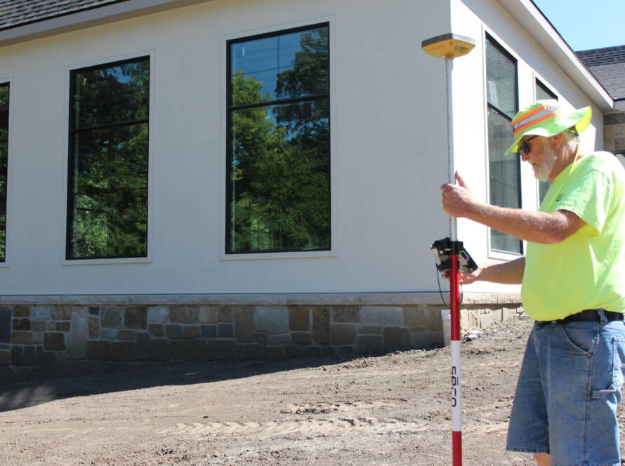
Subsurface surveying offers a practical solution to uncover potential issues before construction begins. Whether you’re preparing for a new build or exploring land surveying Altoona services, understanding what lies beneath the surface is essential.
Identifies Hidden or Unmarked Utilities Before Groundbreaking
Many construction projects face setbacks because of undocumented or improperly mapped underground utilities. These hidden lines are especially common in older developments or areas with incomplete utility records. Subsurface surveying uses advanced tools like ground-penetrating radar (GPR) and electromagnetic locating to uncover what traditional surveys might miss.
Even a single unmarked utility can bring a project to a halt. A subsurface survey ensures that crews know exactly what lies beneath the surface, which helps prevent surprise encounters during excavation. Early identification allows project teams to adjust designs or schedules to work around buried infrastructure, avoiding costly reroutes or damages.
Prevents Dangerous Utility Strikes and Emergency Repairs
Accidentally hitting a utility line doesn’t just stop work—it puts workers and nearby properties at risk. A ruptured gas main or damaged electrical conduit can create hazardous conditions, trigger evacuations, or even cause serious injuries.
Subsurface surveying helps eliminate these dangers by providing accurate utility locations before equipment ever touches the ground. Knowing where gas, sewer, and electrical lines are located gives contractors confidence to dig safely. The result is fewer emergency calls, reduced liability, and a safer work environment for everyone on site.
Allows Conflict-Free Design and Efficient Utility Layouts
Subsurface utility information is invaluable during the design phase. With a clear picture of existing underground infrastructure, engineers can avoid placing new utilities or structures in conflicting locations. This reduces the need for redesigns, relocation efforts, and construction changes.
Better Coordination With Utility Providers
Designing with accurate subsurface data also improves coordination with utility companies. When potential conflicts are identified early, utilities can be relocated in advance or worked around entirely. This minimizes delays caused by waiting on approvals or utility crews.
Smarter Infrastructure Planning
Accurate subsurface data also supports more efficient layouts for water, sewer, storm drains, and electrical systems. Designers can align new installations with existing conditions, helping avoid tight spaces and improving overall system performance.
Keeps Construction Moving Without Delays or Downtime
Time is money on a construction site. Delays caused by utility conflicts often result in idle crews, missed deadlines, and rising costs. Subsurface surveying keeps projects moving forward by eliminating these common disruptions.
When field teams know the exact location of underground utilities, they can plan excavation and installation work with confidence. Clear utility mapping supports better scheduling, smoother coordination between trades, and fewer surprises during site work.
Without the guesswork, crews spend more time building and less time dealing with unforeseen problems. That keeps your timeline on track and your budget intact.
Improves Site Safety and Regulatory Compliance
Construction sites are full of hazards, and utility conflicts can add to the risks. Accurately identifying underground lines helps prevent accidents that could harm workers, damage equipment, or disrupt service to surrounding areas.
In addition to protecting workers, subsurface surveying also supports compliance with OSHA safety standards and local excavation regulations. Many municipalities require utility locating as part of the permitting process. Subsurface data proves that the team has done its due diligence to minimize risk.
Streamlines Permitting and Municipal Coordination
Permitting delays can stall a project before it even starts. Having a complete picture of underground conditions simplifies this process. Accurate utility mapping helps demonstrate to local authorities that the project team has identified and addressed potential conflicts.
Municipal staff and utility providers are more likely to approve plans that clearly show how new construction will avoid or account for existing lines. This reduces review times, eliminates rounds of revisions, and helps keep the entire project moving forward.
Take the Guesswork Out of Construction with Abaci Consulting
Construction teams face enough challenges without having to deal with surprise utility conflicts. From tight timelines and limited budgets to regulatory hurdles and safety concerns, there’s little room for error.
Subsurface surveying addresses these challenges head-on by giving project teams the clarity they need to plan, dig, and build with confidence. If you’re preparing for a build and researching land surveying Altoona options, it’s essential to work with a team that understands how to prevent costly setbacks.
At Abaci Consulting, we’ve spent over 25 years helping clients avoid underground surprises with accurate, detailed subsurface utility surveys. Our local expertise and commitment to precision make us the trusted partner for keeping construction projects safe, efficient, and on track.
Contact us today at 515-986-5048 or abaci@abaciconsulting.com to schedule your subsurface survey and keep your project moving forward without the unexpected.