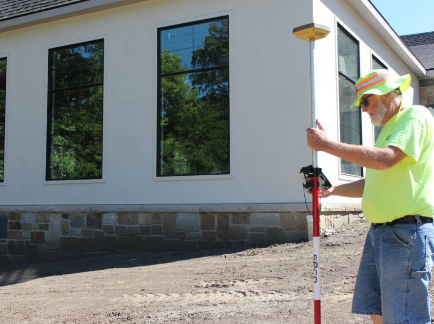
Thoughtful land use planning is essential for supporting Central Iowa’s growth while preserving its natural integrity. Terrain analysis plays a vital role in this process, providing the data developers and municipalities need to make informed, cost-effective decisions
Whether it’s identifying suitable building sites, managing stormwater, or laying out infrastructure, terrain insights are key. Let’s see how terrain analysis helps shape smarter land development in Central Iowa. If you’re searching for a land surveyor Des Moines trusts, understanding the value of terrain data is a great place to start.
Guiding Site Selection and Feasibility in Central Iowa
Central Iowa’s varied terrain can be both an asset and a challenge when planning a development. Through detailed terrain analysis, developers can evaluate topographic features like slope, elevation, and drainage patterns before breaking ground. This insight helps determine the most buildable and accessible parts of a property.
For example, identifying steep slopes or flood-prone areas early allows engineers to adjust site plans and avoid costly complications. With accurate topographic surveys and digital terrain models, decision-makers can assess how land characteristics align with project goals, zoning requirements, and environmental constraints.
This ensures not only regulatory compliance but also long-term usability of the land.
Supporting Effective Stormwater Management Strategies
Stormwater management is one of the most important considerations in Central Iowa land development, especially given the region’s susceptibility to heavy rain events. Terrain analysis informs drainage system design by revealing how water naturally moves across a site.
Designing for Drainage and Erosion Control
Using elevation and contour data, engineers can predict runoff patterns and pinpoint areas at risk of erosion or pooling. This enables the creation of effective retention and detention basins, swales, and grading plans tailored to the site. A well-designed stormwater system protects both the development and the surrounding environment, ensuring compliance with state and local regulations.
Enhancing Environmental Sustainability
By working with the land’s natural features rather than against them, terrain-informed stormwater solutions help preserve natural waterways, minimize impervious surfaces, and reduce downstream flooding. These benefits support sustainable land use and bolster community resilience against extreme weather.
Informing Infrastructure and Utility Layouts
Infrastructure design must align with a site’s terrain to be both functional and cost-effective. Terrain analysis plays a key role in determining the most efficient layout for roads, utilities, and other infrastructure elements.
Reducing Construction Costs and Disruption
Accurate terrain data allows engineers to plan infrastructure with minimal earthwork, reducing the need for extensive grading or retaining walls. For instance, roadways can be routed to follow natural contours, avoiding sharp elevation changes that would otherwise increase construction complexity and cost.
Improving Utility Planning
Utility systems like water mains, sanitary sewers, and storm drains rely on gravity and grade. Terrain analysis helps ensure these systems are laid out efficiently, preventing issues such as backflow, inadequate pressure, or drainage failures. The result is a smoother construction process and a more reliable infrastructure network.
Improving Land Use Efficiency and Compliance
Making the most of a parcel of land while staying compliant with local regulations requires a deep understanding of its physical characteristics. Terrain analysis helps developers achieve optimal land use while preserving environmentally sensitive areas.
Maximizing Buildable Area
By identifying flat or gently sloped zones, terrain analysis helps concentrate development in areas that require minimal modification. This not only saves on site preparation costs but also leaves more space for green areas, stormwater features, or future expansion.
Navigating Zoning and Environmental Rules
In Central Iowa, local zoning ordinances and environmental regulations often dictate how land can be used. Terrain data helps planners identify setbacks, buffer zones, and protected features like wetlands or floodplains early in the process, streamlining the approval timeline.
Reducing Risk and Avoiding Costly Surprises
Many project delays and cost overruns can be traced back to unforeseen site conditions. Terrain analysis mitigates these risks by uncovering hidden challenges before construction begins.
Early Detection of Hazards
From unstable slopes to poorly draining soils, terrain data reveals factors that could impact design, safety, or construction timelines. Addressing these issues proactively reduces the risk of change orders and helps projects stay on schedule and within budget.
Enhancing Developer Confidence
When developers have a clear picture of the land’s characteristics, they can make informed choices about site layout, design scope, and construction sequencing. This leads to better project outcomes and fewer surprises along the way.
Put Terrain Insights to Work for Your Next Central Iowa Project
Terrain analysis is more than just a step in the planning process—it’s a strategic tool that empowers smarter, more sustainable land use decisions across Central Iowa. From site selection and infrastructure layout to stormwater management and risk reduction, the insights terrain data provides are invaluable
For anyone planning to develop land, whether residential, commercial, or municipal, the guidance of an experienced land surveyor Des Moines developers rely on can make all the difference.
Want to build with confidence? Contact us at 515-986-5048 or abaci@abaciconsulting.com.
That’s where a civil engineer comes in. With expert planning and design, these pros make sure your grading plan isn’t just code-compliant—it’s smart, stable, and built to last.
At Abaci Consulting, we understand the land, the weather, and the rules here in Iowa. We work with property owners, builders, and developers to make grading plans that actually work—from the first shovel of dirt to the final sign-off. Give us a call at 515-986-5048 or send an email to abaci@abaciconsulting.com. Let’s get your project started with confidence.